Wednesday, April 29, 2009

Whitney & Thayer Woods

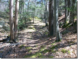
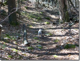
100_0328 There's a place in Cohasset, MA off of route 3a where I love to go with my Sweetheart Beth & my dog Skippy for a walk & short hike. It's called Whitney & Thayer Woods. Not being real close to any real mountains where I live, this place still provides a good way to enjoy nature & stretch the leg muscles some.

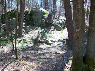
Whitney & Thayer Woods is one of 95 properties owned by The Trustees Of Reservations in MA, comprised of more than 800 acres and over 10 miles of trails within its boundaries. Many of the paths & trails are named after early benefactors of the organization, such as Milliken Memorial Path. In the late 1920s Arthur N. Milliken planted many flowering shrubs as a memorial to his wife, Mabel Minott Milliken. Rhododendrons still bloom here each spring. A grouping of glacial erratics mark certain areas of the landscape, such as Ode's Den. This was named after Theodore "Ode" Pritchard who, after losing his home in 1830, lived under one of the boulders. Bigelow Boulder was named in honor of the late author of the first volume of The Narrative History Of Cohasset.

The Trustees Of Reservations website gives a good synopsis of this beautiful landscape. Here's an excerpt from the website:


Much of Whitney & Thayer Woods was originally the "Common Lands of the Hingham Planters," referring to the colonists who settled the area beginning around 1634. Around 1904, Henry M. Whitney began purchasing parcels of abandoned farmland to create a private estate. The Whitney Woods Association later acquired much of the estate and donated more than 600 acres to The Trustees Of Reservations in 1933. Ten years later, Thayer Woods was also donated, and the Reservation became known as Whitney & Thayer Woods.


The property sits adjacent to another piece of land also owned by the The Trustees, 62 acre Turkey Hill. This area is co-managed by the towns of Cohasset & Hingham and is situated close to Weir Farm. Sitting atop the 187 ft summit of Turkey Hill is the remains of an anti-missile radar control station, built at the time of the cold war & used to help thwart potential nuclear attacks by the then known Soviet Union. It's a basic cinder block structure, now stripped & empty of any equipment it once housed.


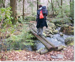
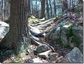
These two properties make for a great day hike, and if100_0332_00 starting from Whitney Woods, you can incorporate a picnic atop Turkey Hill in the spring & summer months. There are several paths within Whitney & Thayer Woods which pass through heavily wooded areas, as well as old carts paths outlining the perimeter of the property. The terrain varies with ups & downs, rocky outcrops & wooden bridges crossing streams & wet areas. The wider paths are used by mountain bikers & runners on a daily basis. During the winter months, the trails are used for both cross-country skiing & snowshoeing.

100_0327_00


A walk around the property at Whitney & Thayer Woods is roughly 2-3 hours. There are bulletin boards providing printed trail maps in designated parking areas, and you can even download a copy from http://www.thetrustees.org/pages/21_trail_map_library.cfm. Many of the secondary trails within the property's confines aren't marked on the map, though markers are placed throughout along the trails & paths. It's possible that some trails or markers are mis-marked, as a couple spots on the map don't agree with the physical terrain. This is been a discussion between Beth & I more than once.


On The Trustees Of Reservations website is listed that interpretive tours & programs are offered during the year. I've never signed up for one, nor do I know anyone who has. If you want more information on this, check out their website.


Here's some other links below with information regarding Whitney & Thayer Woods:


http://www.thetrustees.org/pages/392_whitney_and_thayer_woods.cfm

http://www.thetrustees.org/pages/21_trail_map_library.cfm

Tuesday, April 28, 2009

Book Review Of Epic: Stories Of Survival... by Clint Willis

If you enjoy survival & adventure stories like I do, then Epic:  Stories Of Survival From The World's Highest Peaks should keep you entertained for several nights. This book is a collection of stories from climbers who faced unbelievable circumstances while climbing Everest, K2, Anna Purna and other dangerous mountains.


Each chapter features individual accounts from men such as John Krakauer, Greg Child, Joe Tasker, Peter Boardman, David Roberts, Eric Shipton & Alfred Lansing, as well as many more. Some of the conditions these men faced were extreme, even the worst possible scenarios one could imagine. As I read this collection by Clint Willis, I imagined myself in these particular situations, and tried to visualize just how I'd be able to cope as well as some of these men did. I found myself in one instant believing how crazy they were, yet simultaneously feeling how awesome to survive against such overwhelming odds.

Each time I've found myself in a book discussion with friends or people in general, this book is one I mention quite frequently. Clint Willis has also put out some other collections of mountain rescue expeditions. No doubt I'll be picking up some more of his books. Grab yourself a copy & enjoy!

~The Pilgrim.

Monday, April 27, 2009

Gear Reviews: Granite Gear Virga, Pack Pocket & Belt Pocket

Alright, it's long overdue...my backpack system that I used for my Spring '08 AT Section Hike, and my review. First off, let me say that I tried to keep it all pretty lightweight, though at the beginning of my hike the weight was more than I'd planned it being. As the weeks passed, I modified my methods & shed some pounds. Pack weight with food & water at the start was roughly 35 lbs. The last week it was just under 25 lbs.

Granite Gear Men's Virga Ultralight Pack (Spring 2009)

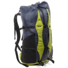
My pack was a Granite Gear Virga Ultralight Pack. It's a frameless pack, meaning that it has no internal stays to support the pack. When it's empty, it crumbles like an empty duffel bag. This is the nature of frameless packs, designed to be shored up by using a foam sleeping bag inserted inside the pack's main compartment. It has a roll-top design with 2 side pockets made of neoprene. The load-lifter straps do a great job keeping the pack tight to the back, and the simple nylon waist belt was comfortable for me. Some people prefer the thicker padded belts as featured on many ultralight packs today, such as on the Vapor Trail pictured below. The Virga is a lighter pack, though, a bit more stripped down.

Granite Gear Men's Vapor Trail Ultralight Pack (Spring 2009)

Weighing in at 1 lb 3 oz, the Virga is slated to carry a load of up to 20 lbs comfortably. When I had 35 lbs filling the 3200 cubic-inch capacity, I could feel it. So when I finally got the weight down, this pack was as advertised. It was comfortable, and durability-wise, this pack is very tough. I love the Granite Gear Virga & recommend it to anyone looking for an ultralight pack with basic but important features.

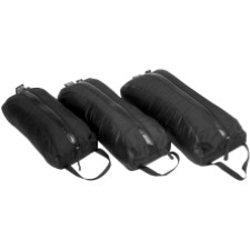
Attached to one side of my pack was a medium-sized Pack Pocket from Granite Gear. The Pack Pocket is attached to your pack by the side compression straps. Great for adding just a little more room to your pack. I had my plastic hole-digger stashed inside, along with tp, wet wipes & my low-cut gaiters. This Pocket will work with many other pack designs which have 2 side compression straps. This is something I highly recommend if you need a place to stash some quick-access items.

Granite Gear Pack Pocket (Spring 2009)

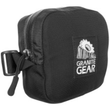
On the waist belt of my pack was the Belt Pocket, also from Granite Gear. I met several hikers who also carried one of these, holding everything from energy bars to cameras & cell phones. Another great item to add to your pack. They come in a left & right version, and I did see a couple of hikers who had both left & right Belt Pockets. Mine was the right hand version. I will say that I needed to do some modifying to my Virga Pack in order to securely attach this thing. It was some simple stitching and not a problem for me, being the son of a seamstress. The Belt Pocket does fit easily onto the thicker padded belt of the Vapor Trail, as well as other brand name packs.

Granite Gear Belt Pocket (Fall 2008)

Well, there you have my backpack system, which totaled barely over 2 lbs. Although there were some others who's pack weight was lower than mine, still I had some envious hikers of me when I answered their question of my pack weight. When I return to the AT, there'll be some changes to how I pack my gear, as I'm always tinkering & fiddling with things. It's a system that works for me, and hopefully this has given some of you a few ideas. So, get some gear & get out there!

~The Pilgrim.

Saturday, April 18, 2009

Ultralight Means Practical

Ray Jardine is most commonly referred to as the father of ultralight backpacking. His contributions to hiking, backpacking, camping, kayaking & other venues of outdoor activities have been limitless. For decades, Ray & his wife Jenny have tirelessly explored the world, building their own gear & constantly seeking ways to improve upon their own ideas. If you've never visited their site, check it out at http://www.rayjardine.com/index.shtml .

Steve Gillman is another outdoor enthusiast who's done much in promoting ultralight hiking. Steve gives a lot of great ideas, many of which I've incorporated into my own hiking & backpacking lifestyle. His site, http://www.the-ultralight-site.com/ has been a resource for thousands of hikers & wilderness students for several years. He runs the gamut with countless ideas regarding ways to shed grams & save weight, not all of which he practices himself. Of all the articles and info I've read by Mr. Gillman, one thing that impresses me is how practical he is. It's one thing to cut weight from your pack, but to go as far as some people go, I feel borders on absurdity.

Ultralight hiking & backpacking isn't just about going "light & fast," a slogan which I feel is mis-leading & not truly indicative of what the ultralight philosophy is. UL hiking isn't just about going as fast as you can. You want to enjoy where you're going & what you're going through, right? UL backpacking isn't simply about cutting as much weight out of your pack as you possibly can, but also in being a practical hiker & common sense backpacker.

It cracks me up sometimes when I hear of extremes that some hikers go to to shave a few grams off their pack weight. Things that go a bit further than cutting your toothbrush in half. I won't go into details here, but I'm sure if you've been around long enough & have dropped in on some hiking forums, you've heard or read some pretty funny things. Some of the things you'll see & hear are that which hikers make up & poke fun at, joking at their own expense. It can be entertaining. One thing every hiker or backpacker needs at all times is a knife. It doesn't need to be a Bowie, but you should have some type of knife. In my pants pocket everyday I carry a Mini-Paraframe by Gerber. There's seldom a day that I don't use it.

UL backpacking is a philosophy which I subscribe to, but not to an extreme degree. My goal here isn't to give a list of ways to cut your pack weight, as Steve Gillman has covered this in depth in his writings. Yet I'll just give some observations concerning UL hiking & backpacking.

  1. Buy reusable equipment. This may sound odd, but in this day of instant this & disposable that, it makes more sense that if one is concerned with going ultralight, they'll invest in equipment that's durable and dependable. This is more practical and in the long run, saves money. I read in a forum where a hiker was looking forward to getting some throw-away toothbrushes, where you get one use from one toothbrush. Huh? Disposable toothbrush, come on now! How practical is that? What a waste of money & time. Not only that, but how can you actually believe you're shedding weight by having to buy several of these things if you're going on a mulit-day hike? UL here means ultra-lame!
  2. When thinking of cutting weight, first think of what you want to carry. We don't usually have too much problem thinking of all the things we'd like to have with us when away from home.
  3. Next, think of what you should carry. This narrows down your list quite a bit. Of course we all bring an item or two that may not really be needed on a hike. That's our choice, and allowing yourself a small luxury in some cases is a good idea.
  4. Decide what you will carry. Sounds simple, but far too many of us have items in our packs that we bring along just because we're not sure if we should. When in doubt, do without.
  5. Focus & be concerned with what you carry, not what others are carrying. Stop telling others that they shouldn't be packing something just because you're not. If they ask for your opinion, that's one thing. But too many hikers feel that they have the authority to pick on other hikers.
  6. This is another should be no-brainer. Hiking your own hike doesn't mean that you're way of hiking is the only right way and everyone else's is wrong. If you're not carrying an mp3 player, fine, but don't expect everyone else shouldn't either. Hike your own hike doesn't mean "you hike the way I hike." 

Last year hiking the AT I met a lot of good people. Some folks I'd love to see again, some others well, you get the idea. I learned some things from both groups of people. I learned that UL is a relevant term, that it's translated in various ways. What works for one doesn't for another. What helps one is a hindrance to another. Hike your own hike, be a practical hiker & common sense backpacker. Be resourceful & take care of your equipment. Respect your fellow hikers & always be ready to help. And of course, always carry a knife. smile_wink

Thanks for reading,

~The Pilgrim.

Wednesday, April 15, 2009

Riga Shelter Salisbury, CT

On April 11th my sweetheart & I drove down to Salisbury, CT for an overnight stay on the Appalachian Trail. Most of the drive there it rained, but as we approached Connecticut, the skies were growing more & more clearer. The forecast called for rain early Saturday, clearing in the afternoon and night, then sunny and 55 degrees for Sunday. We were looking forward to a good weekend hike.

We arrived at the parking lot on Rte 41 which leads to the Undermountain Trail around 4:30 pm. We headed up the trail to the point where it forks to the left with the junction of the Paradise Lane Trail. This lead another half a mile or so until we reached the AT. Turning south on the AT, we stopped a half mile up the trail at the Brassie Brook Shelter for a few minutes, grabbed a snack before heading on to the Riga Shelter, another 1.8 miles away.

100_0299_00 It was overcast & cool on our way to Riga, the trail clear & pretty easy going. The trail crossed over a stream a number of times and we enjoyed rock-hopping & crossing the small bridges when available. The cool breeze and lateness of the day told us we were in for a cold night.

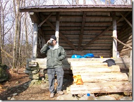
Another hiker was already in the Riga Shelter when we finally reached it; we think his name was Larry, after looking through the shelter register the next morning. He told us he'd been there since Friday night around 9 pm, and that it had rained Saturday until about 1 in the afternoon. So he waited out the rain, reading, and stayed through until Sunday morning.

Riga Shelter sleeps 6 like Brassie Brook, but for some reason, appeared a little smaller than the other shelter. But one of the first things I noticed was the new steps leading up to the shelter, built by the trail maintainers. Larry said they had dropped in 8 loads of lumber by helicopter, enough to build the steps, a new privy & two new tent platforms. They did a great job! My hat's off to all who give of their time & energy in helping to maintain what so many of us take for granted. In the near future, I want to start doing my part in volunteering when I can.

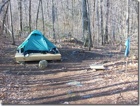
We decided to set up100_0305_00 our tent on the platform directly behind the shelter, about 30 yards away. Beth is a cold sleeper, so I figured it'd be warmer in the tent rather than the shelter. Larry probably enjoyed his privacy, too. Beth cooked our meal of rice & beans with some white chicken while I set up the tent. Some hot tea helped keep us warm till we turned in for the night. There was a wash pit about 10 yards from our tent that we used to clean up. The stream running close by was a relaxing sound as we fell asleep.

100_0310_00 Easter Sunday greeted us with a nice sunrise! Though it was still chilly, we were looking forward to a 55 degree day, or so it was forecasted. Little did we know, it would turn out to be mid-40s at best. But it was sunny, so we still had an enjoyable hike. 100_0312_00

The shelter was empty when we woke, so Larry must've got an early start. We set up the stove near the shelter to warm up some tea & had a light breakfast. We eventually got back on the trail at 9:48 am.

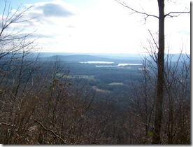
Crisp, cool days always get me moving a bit quicker than hot days, and I enjoy hiking in this weather. The climb up the south side of Bear Mountain wasn't too strenuous, and a bit more taxing for the last 100 yards or so. We had a great view once we reached the summit, climbed up on the remaining rocks of the once standing tower. 

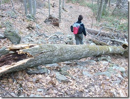
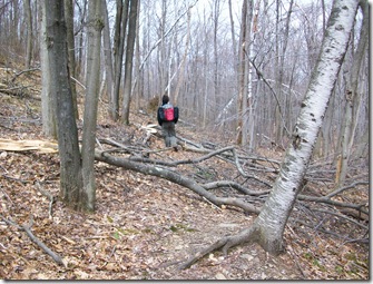
The wind was blowing pretty well, so we didn't stay on top of the tower for long, just long en100_0318_00ough to say  we did & snapped a few pictures.   I was thinking of our trip down the north side of the mountain, as I'd read in an online forum a few days before that there were still many downed trees blocking parts of the trail. 100_0317 The trail maintainers have done a great job in clearing out most of the debris left behind from the ice storms this past winter. It's still pretty early in the season, and I'm sure they'll have the remainder of the stuff cleared away very soon.
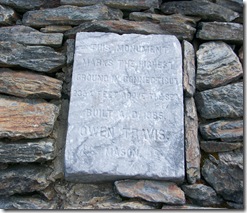
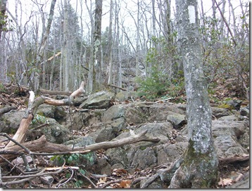
Everything I'd read of hiking the north side of Bear Mountain was pretty accurate. It was real steep in some spots and going was slow, but lots of fun. I can only imagine how tough it was with snow & ice covering the rocks. In some spots we saw marks left from crampons on the rocks, long scraping lines. 100_0320_00

100_0323_00

In several spots along the trail we needed to go around the fallen trees. Most of the damage was found along the north face of the mountain and the base. As we hiked further north, there didn't seem to be as much debris.

100_0326

100_0322

Hiking solo for me is very enjoyable, but I was happy that my sweetheart, Beth, wanted to do this overnight trip with me. We had a great time & enjoyed each other's company, at least most of the time. smile_regular Next trip we do we hope to have a few friends along and, of course, my little buddy Skippy Bones! We missed having him along, but felt it was best to leave him with Beth's dad & his Pug, Zoe.

As we descended Bear Mountain & headed north on the AT, we turned at the junction where it meets with Paradise Lane. From there, another couple miles or so back to the Rte 41 parking lot. We met 3 other hikers  & a dog named Simon who were on their way up to Bear Mountain, talked about our hike & unexpected cooler weather of the day. We reached our car just after 1:30 pm and headed home. Now we're looking forward to the next hike!

~Till next time, The Pilgrim.

Saturday, April 4, 2009

Blue Hills Skyline Trail

Saturday, March 28th I hiked across the Blue Hills Reservation via the Skyline Trail. My sweetheart, Beth, along with Skippy Bones, our Toy Fox Terrier, & a couple other friends decided to take advantage of the proposed nicest day of the weekend, at least according to the forecast. Wouldn't ya know it, the meteorologists were right on; Saturday was a great day for hiking, sunny & in the 50s, and Sunday was a little cooler and rained most of the day. The hike was filled with good climbs, great views & lots of interaction with other people out for a day hike. Skippy also met some new buddies along the trail. 

BlueHllsTrlMap07small

Since the Skyline Trail isn't a loop but in a linear direction, we took two cars. The first car, being the destination car, was parked at the Shea Ice Skating Rink in Quincy. The four of us then drove to Canton and parked in a lot off of Rte. 138.  Looking at the map above, about 1 1/2 inches from the left side, the western section, there's a small green dot. That was our starting point. On the far east (right side) of the reservation is a red dot, our ending position. From one end to the other of the Skyline Trail is about 9 miles, though we skipped a small portion to the west of Rte. 138, our starting point, which accounts for another mile or so. So all in all, we hiked about 8 miles that day. Good time!

If you've never hiked any part of Blue Hills before, & you live within an hour's drive, you should check it out. On the last mile or so of our trip, we came across some rock climbers on Rattlesnake Hill. Each year, the Boston Chapter of the AMC hosts The Beginner Rock Climbing Program. They happened to be there that same day, so we stopped for a few minutes & watched. I've never done any climbing, but am seriously interested in doing it. Maybe this time next year Beth & I will set aside the time to do it.

This hill was the last good climb on the day, with the back side being a good cool down period, as we moved through the St. Moritz Ponds area. Somewhere near Rattlesnake Hill a few years back, Skippy & I came across a couple Timber Rattlesnakes that were mating. That was awesome! The month was August and, from what I've read, is the time when they do mate. Skip had scared them off into a bush just as I was about to snap off a couple great pics. But I moved slowly, further into the bushes and still managed to get some fairly nice pics of the 2 snakes. One was very dark, maybe even black colored, and about 4 feet long. The other was smaller, 2 1/2 - 3 feet in length, and tan & yellow. Timber Rattlers come in a wide range of colors, and along with the Copperhead, are the only poisonous snakes found in Massachusetts.

Check out these other links for Blue Hills info, as well as some regarding Timber Rattlesnakes & Copperheads.

www.timberrattlesnake.net

www.copperheadsnake.net

www.umass.edu/nrec/snake_pit/

www.mass.gov/dcr/parks/metroboston/blue.htm

~The Pilgrim.